

Scientists to set sail to survey the seafloor around the Hunga-Tonga Hunga-Ha’apai volcano to help protect people living in high-risk areas from future natural disasters
New Zealand’s National Institute for Water and Atmospheric Research (NIWA) scientists are sailing to Tonga this week to survey the ocean around the Hunga-Tonga Hunga-Ha’apai volcano after the devastating eruption in January.
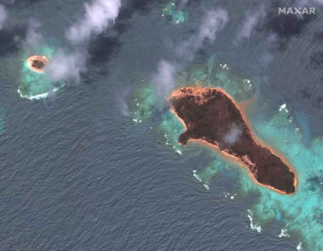
Thousands of square kilometres of the seafloor will be surveyed, with video capturing the eruption’s impact from NIWA’s research vessel, RV Tangaroa.
The ship will leave on Saturday, 09 April, and the knowledge gained will be vital to help protect people living in high-risk areas from the impacts of similar natural disasters in the future.
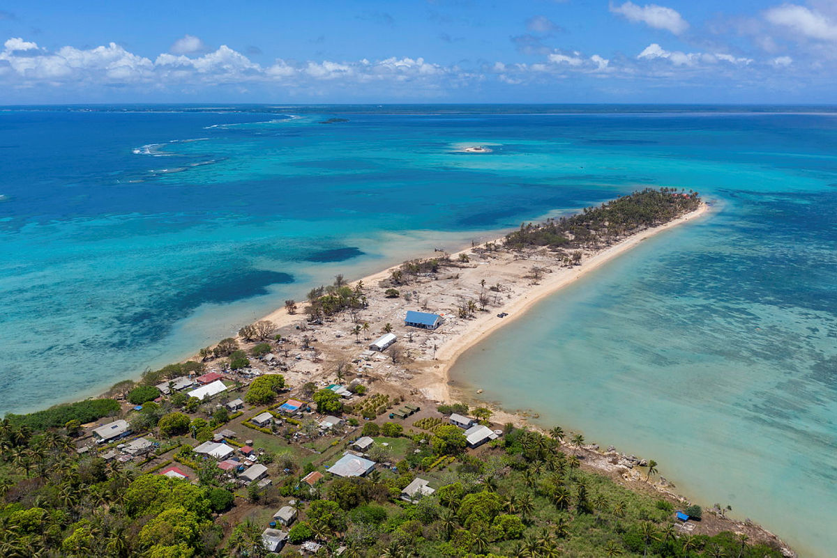
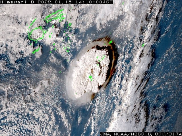
Hunga-Tonga-Hunga-Ha’apai erupted on 15 January, causing a tsunami which devastated parts of Tonga. New Zealand sent aid, as did countries such as the United States and Australia, and scientists called it the most explosive eruption in 30 years.
NIWA scientist Rob Murdoch said at a media conference for the voyage on Friday, the aim of the NIWA-Nippon Foundation Tonga Eruption Seabed Mapping Project was to map the undersea changes to the shape of the volcano, the spread of sediment, learn more about the breakpoint of the fibre optic cable, and determine the impact on sea life.
It’s an international effort. Funding is coming from The Nippon Foundation, a Japanese non-profit grant-making organisation. Chairman Yohei Sasakawa said via videolink: “I think that this is going to become quite important to prepare for the similar natural disaster for this Pacific Rim countries.”
Eighty percent of volcanoes along the Kermadec arc, which runs between Japan and New Zealand, are known to be volcanically active.
Tonga’s Deputy Secretary for Natural Resources, Taniela Kula, who spoke via video link, said the waves destroyed more than 600 structures, including 300 homes, displaced 1525 people, and killed four people.
“As a country, we’re building back slowly. We hope this research will help in the effort to protect our nation and others like us in the future,” he said.
Voyage leader marine geologist Kevin Mackay said they would have to “rewrite the science books to understand what happened on 15 January”.
The voyage would be the first part of the mapping project, with a second part, the deployment of an unmanned vessel further afield between May and July.
“It is estimated that the energy released by the eruption was the equivalent of somewhere between four and 18 megatons of TNT,” MacKay said. “We anticipate major changes to the seafloor around the volcano.”
The crew would be capturing underwater imagery, video and samples from the seafloor using a range of equipment.
Chief executive Ben Simpson of Sea-Kit International, the British company providing the autonomous boat set to undertake a month of seabed mapping for the second part of the mission, said via video link its “uncrewed surface vessels”, or USVs, were a safe, low-emissions alternative to sending a crewed boat.
It was expected to use 100 litres of fuel a day – two percent of what a manned vessel would use. This would be the first time it was used for this kind of task.
“USV Maxlimer will be controlled from the other side of the world, at our base in the UK, as she safely gathers a range of data types from inside the caldera for a full month to develop and support understanding of the eruption’s undersea impact,” said Simpson.
This story was Kate Green, originally published at Stuff NZ on 01 April 2022, reposted via PACNEWS.