
NIWA team discover that volcanic eruption in Tonga discharged at least 9.5 cubic kilometres of displaced material, making it one of the most massive eruptions in the world
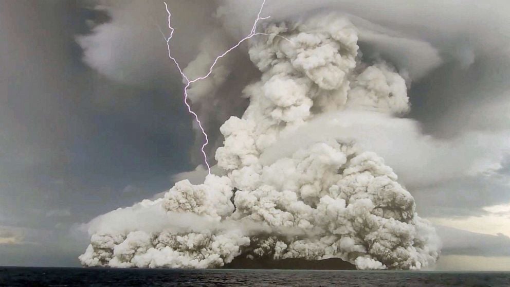
When the underwater volcano Hunga Tonga-Hunga Ha’apai erupted in January this year, scientists knew something extraordinary had happened.
An ash plume shot 57 kilometres into the atmosphere; shock waves rippled through the atmosphere, and the eruption triggered a tsunami that reached heights of more than 19 metres above sea level.
But masked by the waters of the Pacific Ocean, what happened beneath the surface has largely remained a mystery.
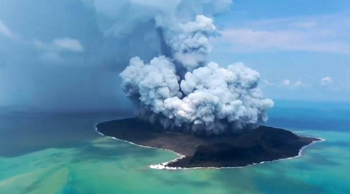
In an effort to better understand the sequence of catastrophic events that came both before and after the eruption, scientists have spent the past few months scanning the sea floor looking for clues.
The team of oceanographers, biologists and geologists led by New Zealand’s National Institute for Water and Atmospheric Research (NIWA) – with the help of an uncrewed boat remotely controlled from Essex in the UK – joined forces to produce one of the clearest pictures to date of what took place underneath the water.
By comparing this newly captured data with a sea floor model from 2017, scientists at NIWA were able to calculate just how much material the volcano erupted. The volume of material displaced in an eruption is a common measure of the size of a volcanic event.
It’s also a key metric in determining where an eruption sits on the Volcanic Explosivity Index (VEI) – similar to the Richter scale for earthquakes.
They found the Hunga Tonga-Hunga Ha’apai spewed out at least 9.5 cubic kilometres of material – a third more than the team’s initial estimates.
By comparison, the 1991 eruption at Mt Pinatubo in the Philippines discharged 5.5 cubic kilometres of material and 4 cubic kilometres was erupted over Naples from Mt Vesuvius in 79AD.
“So we’re talking a truly globally massive eruption,” Mackay said.
The findings show that two-thirds of the displaced material came from the caldera, what is now the huge hole left behind inside the volcano. The rest of the material came from the volcano’s rim and flanks.
The fact the exterior looks relatively unchanged despite losing such huge volumes of material shows just how big the volcano is.
The sea floor survey mapped an area within a 20-kilometre radius of the volcano. In that area, they found 6.7 cubic kilometres of the displaced material and another recent study found 1.9 cubic kilometres of material ended up in the atmosphere.
So where did the rest of the material go?
To find out, scientists took core samples from the sea floor beyond the area that they had mapped. Incredibly, they found material from the eruption 80km from the volcano.
Mackay said their findings showed the material had been transported that distance in what’s known as pyroclastic density channels – a violent and fast-moving mixture of searing hot rocks and gases.
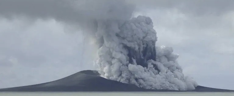
When the roof of the caldera collapsed, it triggered what’s known as a phreatomagmatic eruption, where hot magma comes into contact with relatively cooler water to create immense amounts of steam.
The transfer of energy created an explosion akin to a shotgun blast that fired volcanic rock and ash into the sky. Weather satellites captured the blast, which was so powerful that it sent shock waves rippling through Earth’s atmosphere.
The data captured by Mackay reveals that as that rock and ash came crashing back to Earth, it formed these pyroclastic density channels.
Basically, underwater avalanches that tore along the sea floor at speeds of up to 100kmh. On the land, these flows are the most deadly of all volcanic hazards.
While the NIWA scientists found evidence the pyroclastic flows travelled 80km from the volcano, they believe they could have reached as far as 100km away.
“[This] just supersized any observation ever made in science. And it’s just really left scientists scratching heads going ‘Wow. How did this happen?’,” Mackay said.
These avalanches also help explain the destruction of Tonga’s underwater communication cables, which were severed in the aftermath of the eruption cutting the Pacific island nation off from the rest of the world.
The domestic communication cables linking Tonga’s mainland to its outer islands run about 20km to the east of the volcano.
It was decimated, according to Mackay, as this underwater avalanche ripped through the sea floor. The cable is now covered under 30 metres of volcanic material.
This mass of molten rock and gas was so powerful that it forced its way up and over an enormous underwater ridge line and into a valley to the south of the volcano where it crushed Tonga’s international communication cable. This line provided internet connectivity to the Pacific island nation.
“The sheer force of the flows is astonishing,” said Dr Emily Lane, principal scientist in NIWA’s natural hazards division.
To produce this sea floor map, the researchers used a device known as a multibeam echosounder. It’s like a fish finder, that you might find on an amateur fishing boat, but on steroids.
Instead of pulsing just one soundwave, it fans out hundreds of pulses simultaneously in different directions to produce a 3D map of the sea floor.
To get a complete picture of the sea bed, the vessel carrying the echosounder captured the data in strips. Mackay likened it to mowing the lawn.
“We go up a line mowing three-dimensionally, one strip of the sea floor and then turn around and then mow the adjacent strip,” he said. “Over time we build up this great three-dimensional image of the sea floor.”
The sea floor mapping took about two months and covered about 22,000 square kilometres.
Most of that area was mapped using NIWA’s research vessel, but for the areas directly over the caldera where the conditions were more hazardous, they used what’s known as an uncrewed surface vessel.
This remote-controlled boat was able to travel to the most dangerous areas directly over the enormous cavity, allowing scientists to spot volcanic activity emanating from a newly formed cone near the western ridge of the caldera’s rim. Kevin Mackay said while the risk of any further major eruption was extremely low in the near future, he believed the continued activity could lead to the birth of a new island as the cone continued to accumulate volcanic matter.
This story was written by Mark Doman and Alex Palmer, originally published at ABC on 21 November 2022, reposted via PACNEWS.